
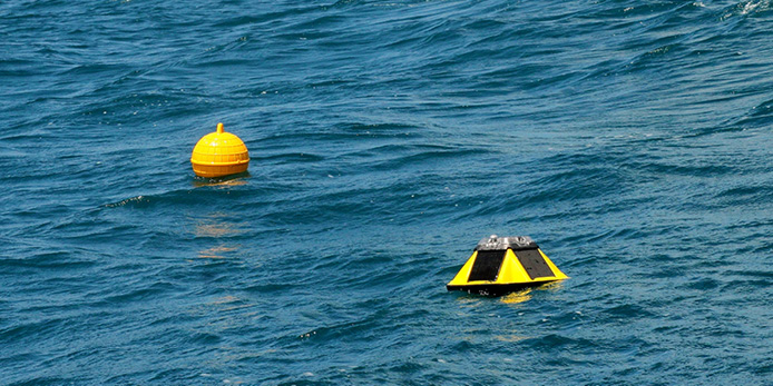
Waves are a fundamental component of the ocean–atmosphere system, transporting energy and momentum across the ocean and playing an important role in understanding climate variability.
Accurate observations of coastal waves are critical for understanding and predicting coastal processes. Wave measurements are used to develop, validate and improve numerical models, support hazard forecasting and data assimilation, and inform coastal engineering and adaptation planning as sea levels rise and wave climates change.
High-quality coastal wave observations also support a range of operational and economic activities, including ports, defence, resource extraction, aquaculture and environmental management, as well as recreational activities.
For a country with more than 30,000 kilometres of coastline, having reliable observations of how waves behave along the coast is particularly important. Yet Australia’s wave observations have historically been collected through a range of regional programs, with gaps in spatial coverage and differences in how observations have been collected, processed and made available.
Over the past decade, IMOS has been working to address these challenges and build a more nationally coordinated approach to coastal wave observing.
From individual observations to a national network
Early investments included support for additional wave buoy sites through the National Mooring Network, helping to expand observations in areas where data were limited. IMOS subsequently established the Surface Waves Working Group to bring together organisations involved in wave observing and improve national coordination.
At the same time, IMOS’s Australian Ocean Data Network (AODN) began bringing together Australia’s existing wave buoy observations.
This work resulted in the National Wave Archive, the first time Australian wave buoy data had been brought together in a single repository. IMOS has also supported tools including IMOS OceanCurrent Surface Waves and AusWaves to improve access to and visualisation of wave information.
Through the IMOS New Technology Proving capability, lower-cost wave buoys were tested against established instruments in Western Australia, Victoria and Northern Territory.
“Over the past decade, IMOS has progressively enhanced Australia’s wave observing capability through targeted investments in new infrastructure, technology evaluation, data standardisation and open data access.
These efforts have culminated in the IMOS Coastal Wave Buoys Facility, which provides a nationally coordinated network of coastal wave observations that complements Australia’s long-established state monitoring programs.
Together, these networks are delivering the sustained, high-quality data needed to improve coastal hazard forecasting, support research and marine operations, and help communities make informed decisions as our coastlines respond to environmental change.”
Michael Cuttler, IMOS Coastal Wave Buoys Facility Lead
A nationally coordinated coastal wave network
The IMOS Coastal Wave Buoys Facility was established in 2024, building on this earlier work. The Facility extends Australian wave observing capability and provides a nationally coordinated approach to in situ wave data collection, quality control processing and data access.
Sites are selected using a combination of national-scale modelling to identify gaps in the existing observing network and input from regional stakeholders. This approach has enabled the network to target areas where new observations can provide the greatest value.
Crucially, IMOS Coastal Wave Buoys is currently the only provider of spectral wave data available in real time at a national scale in Australia.
Seeing coastal hazards as they happen
Since deployments began in 2024, the IMOS Coastal Wave Buoys Facility have captured major coastal events including Tropical Cyclone Narelle, which impacted Queensland, Northern Territory, and Western Australia; as well as Tropical Cyclone Alfred and several East Coast Lows which caused significant erosion in New South Wales and Queensland. In Victoria and South Australia, where publicly available wave observations have historically been more limited, the network has captured multiple winter storm events with spectral significant wave heights regularly exceeding four metres at numerous sites.
Operationally, the network was used for near real-time monitoring of a severe marine heatwave in Western Australia and a harmful algal bloom in South Australia, with state agencies in both regions using the temperature data from the network as one of their key data sources.
In South Australia, they have supported research into wave climate, coastal erosion and headland bypassing. In Victoria, the observations have contributed to studies of erosion, inundation, wave climate and sea-level-rise impacts.
These applications demonstrate the value of having sustained observations available alongside models and other coastal datasets. Observations can help validate models, improve understanding of coastal processes and provide a clearer picture of what is happening during extreme events.
Filling the gaps and new opportunities
Australia still has important gaps in its coastal wave observations, such as parts of northern Australia and the Great Australian Bight. These observational gaps are due to the logistical constraints of operating in these regions. The Facility has identified the importance of collaborating with regional stakeholders to expand observations in these areas in the future.
Together with long-term state wave buoy programs, the IMOS Coastal Wave Buoys Facility is providing continuous observations from moored wave buoys across intermediate (~100 m) to shallow (10 m) areas. When combined with IMOS satellite remote sensing observations, Australian wave monitoring efforts provide large-scale coverage of wave observations across Australia. One key gap that remains is deep water (>250 m) wave observations. Costs remain a major impediment to deep water wave observations, however, drifting buoys and new technologies offer a potential alternative to moored buoys in these deepwater areas that could improve coverage.
Supporting Australia’s coastal future
By combining technological innovation, sustained observations, and stakeholder engagement, the Facility will play a central role in supporting evidence-based coastal management and long-term climate adaptation strategies.
The Facility is also one of the initial investments contributing to CoastRI, the new NCRIS capability designed to strengthen Australia’s ability to observe, understand and respond to change across the coastal environment.
Integration of the IMOS Coastal Wave Buoys with CoastRI will improve observing efficiency and expand data applications, supporting model validation and data assimilation while enabling co-located observations of waves, water levels, currents, erosion and other environmental variables.
To date, the network has 58 coastal wave observing sites across Australia (23 supported directly by IMOS and 35 additional co-invested sites) operated with regional partners.
Read the IMOS Coastal Wave Buoys Facility paper published in the Marine and Freshwater Research special issue here.
Header image Matt Hatcher, UWA