Data from the IMOS Ningaloo mooring is now available via the AODN Portal.
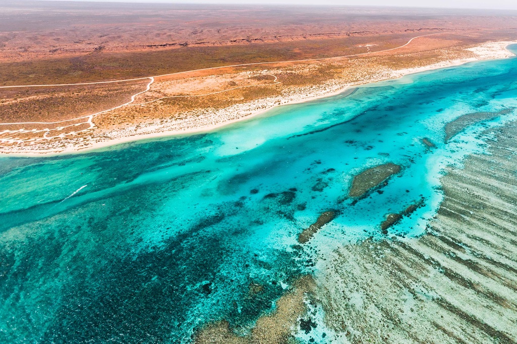
The IMOS Ningaloo mooring, deployed in waters off Tantabiddi on the North West Cape, has extended the geographical range of the IMOS moorings in Western Australia. The mooring has been deployed at the site since August 2019, and is made possible with co-investment from the Western Australian Government.
Ningaloo Reef is a UNESCO World Heritage listed marine park, is adjacent to the highly productive fisheries in the Exmouth Gulf and the North West Shelf, and is the source of the Leeuwin Current.
The strategic location of the IMOS Ningaloo mooring provides valuable monitoring of this important region, as well as the strength of the Leeuwin Current.
The IMOS Ningaloo mooring, on the narrow shelf off North West Cape, captures the temperature and flow of the tropical waters that feed into the Leeuwin Current. The Leeuwin current brings warm water from the tropics southward along the coast of West Australia and the presence of these warm waters helps define coastal ecosystems from Ningaloo Reef to the Capes in the southwest.
Variations in the strength of the Leeuwin Current have ramifications for these ecosystems and this was never more evident than in the unprecedented 2011 marine heatwave event.
In 2011, the Leeuwin Current was at record strength during a La Niña event when tropical waters to the north of Australia are warmer than average. The marine heatwave damaged the scallop and abalone fisheries but also caused coral bleaching, loss of kelp forests and seagrass beds and, in many regions, these ecosystem foundation species have not recovered.
The IMOS Ningaloo mooring occupies a location that had been continuously occupied by an Australian Institute of Marine Science (AIMS) mooring since 1997, which was accompanied by an IMOS National Reference Station during the period 2010-2014. The IMOS Ningaloo mooring is building on these historical time series, by continuing to deliver data for the long-term monitoring of the region.
The IMOS Ningaloo mooring is deployed at 100m of water depth and includes sensors to measure salinity, temperature and current profiles through the water column.
How to access the data via the AODN Portal:
The IMOS Ningaloo mooring data can be downloaded from the following data collections (with the site code TAN100):
Gridded Temperature Time Series product
IMOS- Australian National Mooring Network Facility -Current Velocity time-series.
IMOS- Australian National Mooring Network Facility – WQM and CTD burst averaged data.
IMOS Australian National Mooring Network Facility – Temperature and salinity time series.