As our oceans continue to change at unprecedented rates, the data collected by IMOS is increasingly important in helping to understand the state and trends of our environment.
The impact of natural disasters currently cost the Australian economy at least $38 billion per year and is projected to rise to $73 billion per year by 2060. However, the environmental impacts are incalculable.
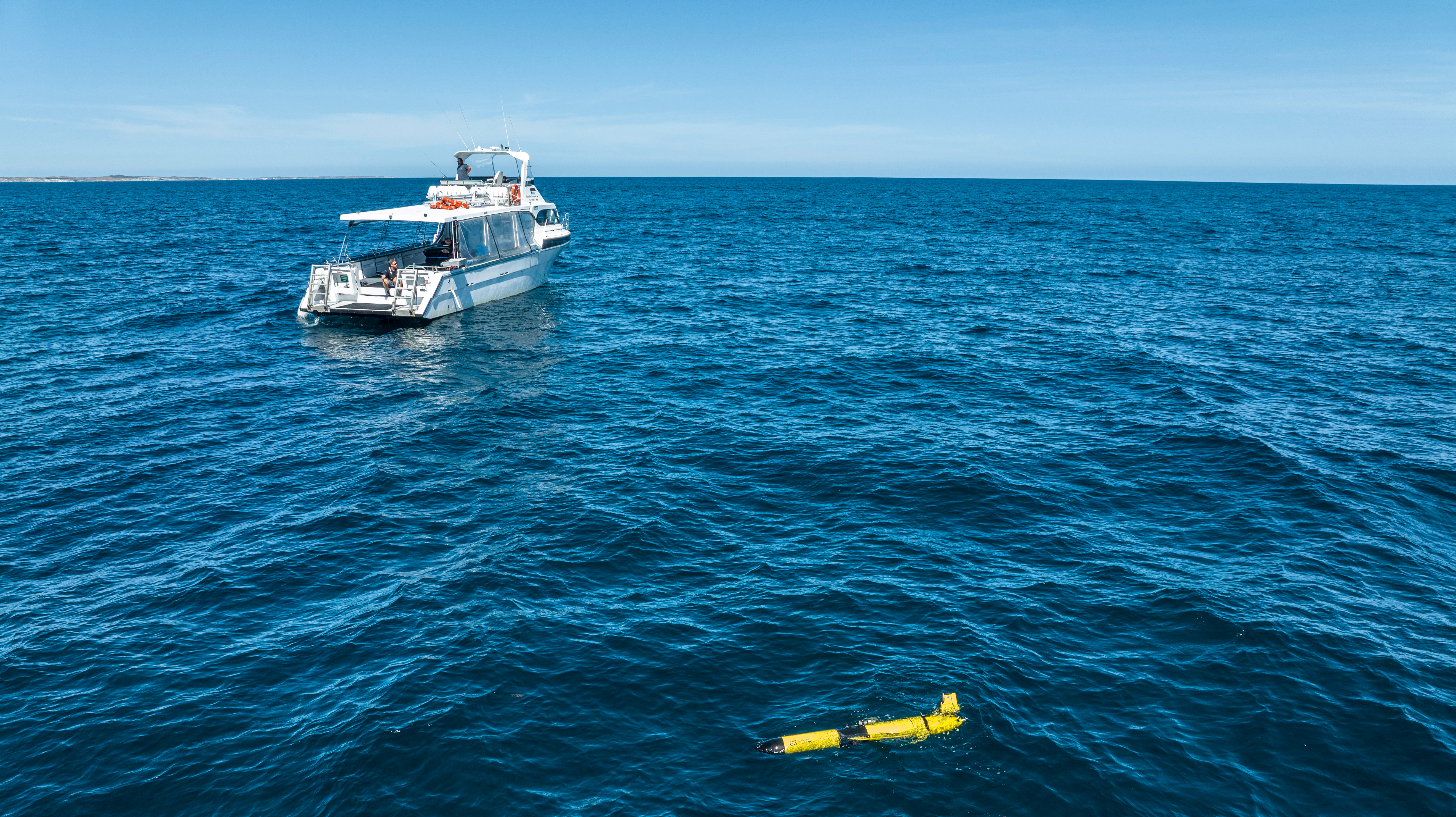
IMOS monitors marine heatwaves in Australian coastal waters with ocean gliders through our Event Based Sampling sub-Facility. IMOS is extending the scope of the sub-Facility to observe marine events beyond marine heatwaves to include river outflows due to floods, marine cold spells and extreme weather events such as tropical storms and cyclones. The number of ocean glider deployments is also increasing from four to eight possible deployments per year.
The ocean gliders provide high-resolution temporal and spatial observations of sub-surface ocean temperature, and their relative portability make them a valuable tool for monitoring extreme marine events. The ocean gliders not only measure temperature but also key bio-physical variables (including oxygen, chlorophyll, salinity) which aids in understanding the growth, peak and decay of these events and their potential impacts on the marine environment.
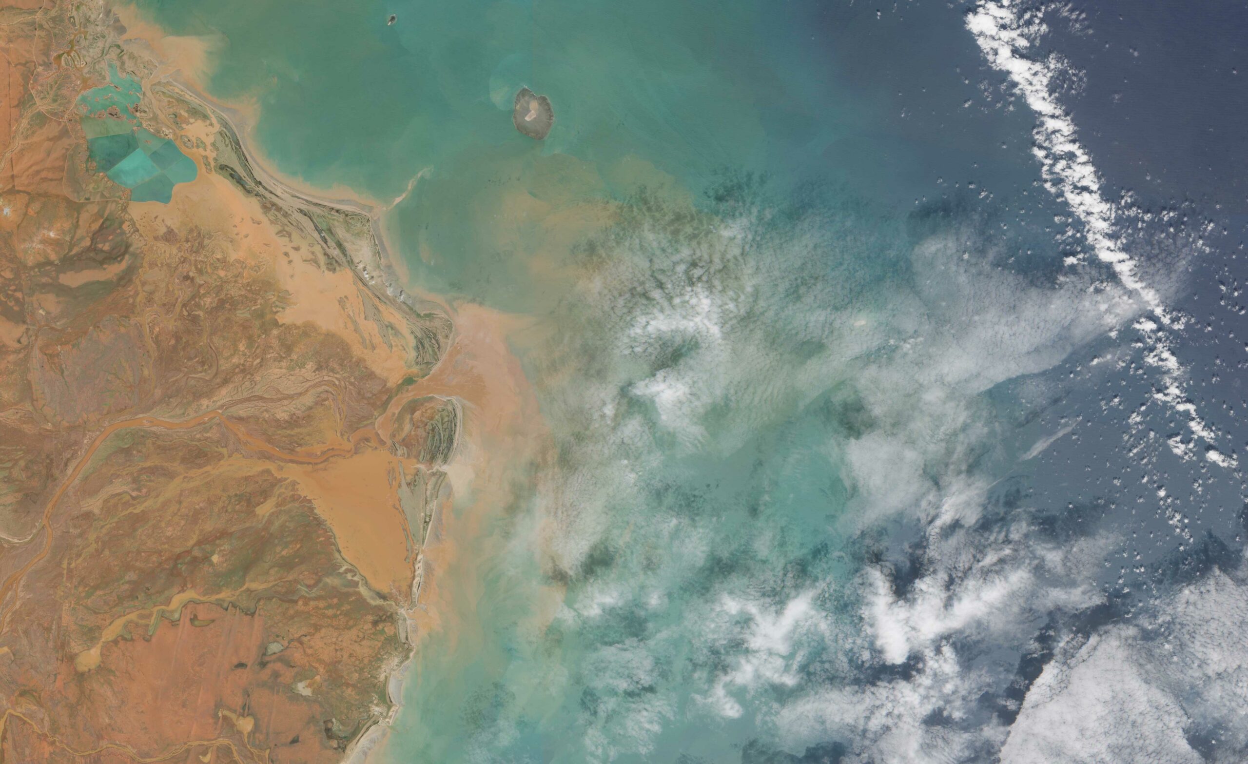
Sentinel-2 Satellite image from 19 February 2025, demonstrates the results of rain from Tropical Cyclone Zelia and its effects on the De Grey River catchment in the Pilbara region of Western Australia.
IMOS has set up a national steering committee for the Event Based Sampling sub-Facility who meet monthly to discuss a list of priority indicators, data sources, and tools for monitoring marine heatwaves and now other events, through their growth, peak, and decay phases. The committee reviews and evaluates available evidence and indicators to assess the likelihood of marine heatwave events and the likely geographic regions to be impacted.
The committee has developed a set of principles to aid in the prioritisation of the potential deployment locations and the timing of ocean glider deployments per year.
This priorisation is based on criteria including: predicted impacts including ecological consequences; gaps in our knowledge of the underlying processes; the potential consequences for fisheries, aquaculture and the broader community; likely scale of potential events in both space and time; accessibility to facilities to enable deployment, and the availability of existing and supporting meteorological and oceanographic observations and models.
With a high occurrence of marine heatwaves and large-scale river runoff events in recent years the sub-Facility has deployed gliders around the country, with some leveraging routine deployments of the fleet of gliders that IMOS has in the Ocean Glider Facility.
The frequency and scale of these events are increasing with the most recent summer seeing marine heatwave conditions around the country simultaneously impacting several critical ecosystems, fisheries and other biodiversity.
The data collected by the gliders complements data streams from other platforms such as moorings, wave buoys, and remotely sensed data products, to provide a four-dimensional picture of the extreme event by increasing spatial and temporal resolution.
The national Steering Committee includes key stakeholders to ensure representation that captures the complete information pipeline from data creation to end-use. These stakeholders also represent the views of their own stakeholders ensuring the produced data is user-friendly. The Committee composition provides a pathway for easier and deeper engagement between meetings, ensuring data providers and scientists can be more responsive and provide tailor-made knowledge in near real-time. The Committee is currently growing the number of stakeholders in its membership to build on this approach.
Images: David Hughes, CSIRO