Sensors on Temperate Merchant Vessels
Sensors on Temperate Merchant Vessels
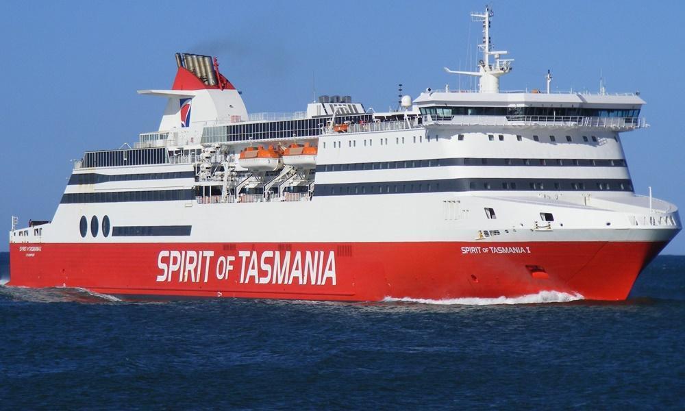
Sensors on Temperate Merchant Vessels use autonomous water sampling equipment installed Spirit of Tasmania 1 to continuous monitor Port Phillip Bay and the Bass Strait. The regularity and consistency in voyage track between the two ports provides high-quality repeat sampling of marine conditions.

The system
The system has been highly useful already, having been applied to monitoring of channel dredging and to calibrate complicated numerical models of Port Phillip Bay. The ship path includes a north-south transect through the inner bay and runs across the Sands region which is the dominant zone of mixing and flushing. It then crosses Bass Strait, supplying unprecedented open water information.
The configuration of the marine monitoring system was modelled on a simple robust design used by the University of British Columbia’s Earth and Ocean Science Department on BC Ferries networks between 2002 and 2006.
Instrumentation and data
It is a compact sensor pack (400mmx 150mm x 200mm) that can be mounted horizontally or vertically in a location convenient to the vessel operator. The system includes a Seabird SBE45 thermo-salinograph (TSG), a Wetlabs combination fluorometer turbidity sensor (FLNTU) to measure temperature, salinity, turbidity and chlorophyll across Bass Strait.
The observing platform became operational in September 2008 and provides an unbroken record, except when the vessel is taken offline for a 3 week refit every 12–18 months.
Key data streams
Select a key data stream to view all IMOS Facilities that collect that data.
Useful information
Acknowledging IMOS
Users of IMOS data are required to clearly acknowledge the source material by including the following statement:
Australia’s Integrated Marine Observing System (IMOS) is enabled by the National Collaborative Research Infrastructure Strategy (NCRIS). It is operated by a consortium of institutions as an unincorporated joint venture, with the University of Tasmania as Lead Agent.


