The IMOS Satellite Altimetry Calibration and Validation sub-Facility have been selected to be part of the global SWOT Science Team.
Preparations for the launch of the Surface Water and Ocean Topography (SWOT) mission are ramping up with the recent announcement of the 2020-2023 SWOT Science Team. Launching in early 2022, SWOT is an ambitious mission that aims to observe global water surfaces between ±78° latitude at unprecedented high resolution using a swath-based altimeter.
The IMOS Satellite Altimetry Calibration and Validation sub-Facility were one of 56 teams selected for inclusion into the SWOT Science Team. Other Australian contributions include the IMOS Ocean Current team, plus work on Southern Ocean dynamics (led by Benoit Legresy) and untangling deterministic and non-deterministic ocean processes (led by Shane Keating). The science team seeks to maximise the value and understanding that will flow from an avalanche of SWOT data in coming years.
Before SWOT settles into its main orbit that will cover the Earth every 21 days, the first 90 days of the mission will be flown in a “fast-sampling” phase, revisiting select parts of the Earth every day. The Bass Strait altimeter validation facility is well placed, located directly in the fast-sampling footprint – this gives a unique opportunity to connect a sustained 25+ year record of altimetry validation with this new and exciting mode of ocean measurement.
Key to validating this new approach to satellite altimetry is highly accurate observations of in situ sea surface height – something that is assisted by Global Navigation Satellite System (GNSS) equipped buoys in use at the Bass Strait facility.
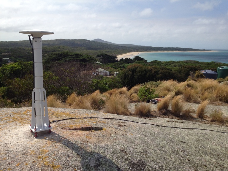
A critical part of that jigsaw is millimetre level positioning of the Earth’s crust, and quantifying the water content of the atmosphere. As part of their preparations at the Bass Strait site, the IMOS Altimetry Validation team are currently testing a new land based GNSS receiver installed on Three Hummock Island. Set to operate over the duration of the SWOT fast-sampling phase, this receiver will assist in accurately positioning a suite of buoys and other moored sensors located in SWOTs new footprint.
For further information on the SWOT mission.
