Through IMOS the Bureau of Meteorology has converted the existing Australian Global and Regional Multi-Sensor SST Analyses to comply with the latest International Group for High Resolution SST file format.
The new versions of the GAMSSA and RAMSSA SST analyses (level 4 or L4) (https://www.ghrsst.org/wp-content/uploads/2016/10/GDS20r5.pdf), can be more widely used internationally, and provide useful additional information in the files, such as sea-ice concentration, estimated analysis error and which data streams contributed to each analysis.
The new IMOS L4 analyses will also complement the existing IMOS “level 3” SST products by providing users with gap-free SST values on a daily basis, but at a coarser grid resolution and lower feature resolution.
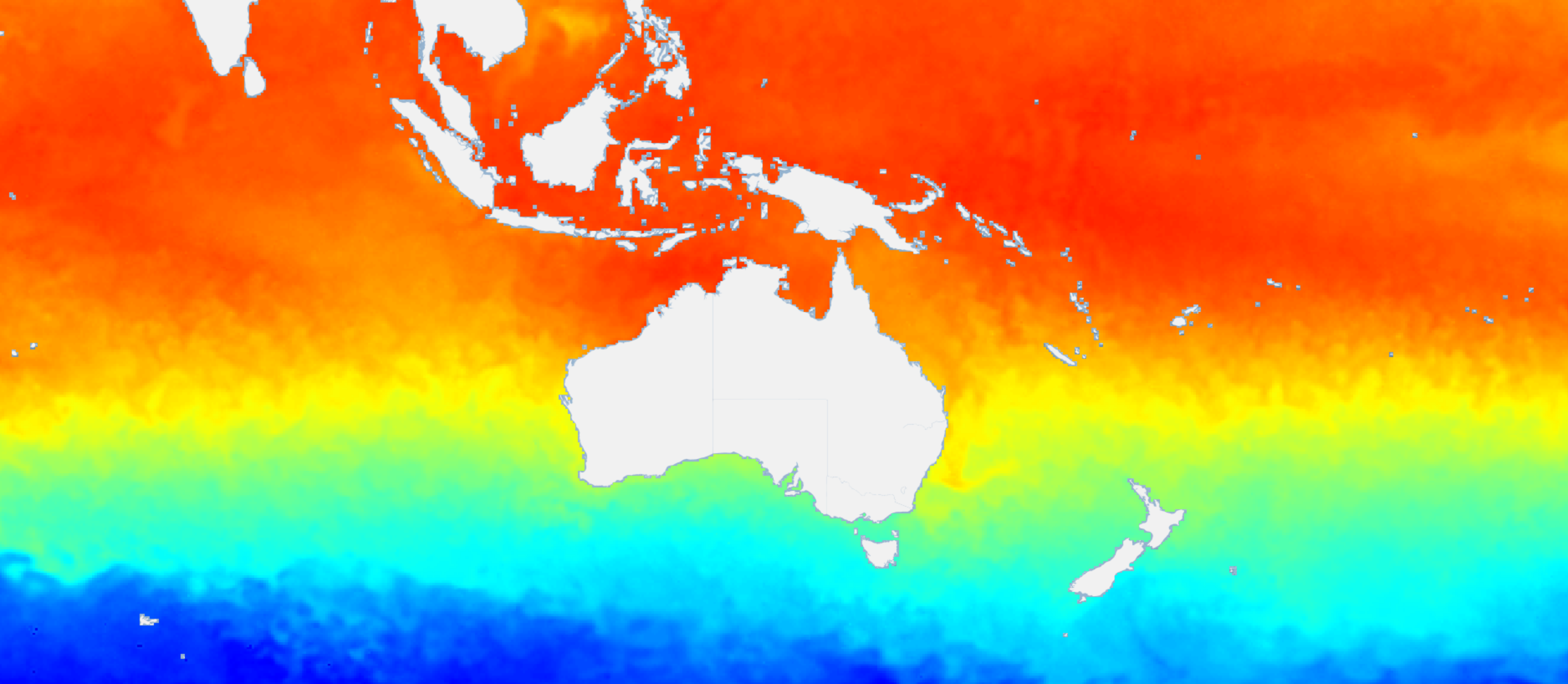
For several years, IMOS has supplied composite (“level 3”) sea surface temperature (SST) products using measurements from infra-red sensors aboard NOAA polar-orbiting satellites. These products provide very high resolution (~2 km) SSTs in the oceans around Australia, and are most suitable for applications requiring accurate SST values in coastal regions, but do not provide data in areas obscured by cloud.
There are a wide range of “level 4” SST products available that statistically interpolate satellite observations to provide a gap-free SST analysis (see https://www.ghrsst.org/ghrsst-data-services/products/). Amongst these are the Australian Global and Regional Multi-Sensor SST Analyses (GAMSSA and RAMSSA), which provide gap-free, daily SST values on a regular 0.25° and 1/12° grid, respectively. These SST analyses have been produced in near real-time by the Australian Bureau of Meteorology since 2007, and are formed through optimal interpolation of SST observations by blending observations from infra-red or microwave radiometers on polar-orbiting satellites, with in situ SST from buoys and ships, exploiting the strengths of these different sensors.
Microwave radiometers can measure SST over regions obscured by cloud, but not within around 50 km of land, whereas infra-red radiometers measure SST to approximately 1 km spatial resolution, but not under cloud. In situ sensors can supply point observations of SST data in cloudy near-shore regions not available via satellites, but are relatively sparse.
Unlike the IMOS “level 3” products, which provide either daytime or night-time “skin” ocean temperatures at around 10 micron depth, GAMSSA and RAMSSA provide daily “foundation” SST estimates, equivalent to pre-dawn temperatures at around 0.2 metres depth. However, as the observations used for the analysis have been selected for only well-mixed ocean conditions, these temperatures are similar to temperatures down to approximately 10 metres. See Beggs et al. (2011) for more information.
Direct links to the new SST analyses:
Australian Regional Multi-Sensor SST Analyses: RAMSSA – Australia
Australian Global Multi-Sensor SST Analyses: GAMSSA – World
This article is based on content from Helen Beggs of the Bureau of Meteorology.
Feedback on the RAMSSA and GAMSSA products or the AODN Portal is welcome. Please send correspondence to [email protected]