The tags were deployed in a recent expedition to the Tiwi Islands as part of a collaboration between the Department of Defence, Integrated Marine Observing System, Sydney Institute of Marine Science, the Australian Institute of Marine Science, and the Tiwi Islands Marine Rangers.
Olive ridley turtles (Lepidochelys olivacea) are an endangered species that occur in mostly coastal waters, especially in soft-bottomed habitats.
The species has a worldwide distribution across the tropics. In Australia, olive ridley turtles occur along the coast from southern Queensland and the Great Barrier Reef, northwards to Torres Strait, the Coral Sea, Gulf of Carpentaria, Arafura Sea, and Joseph Bonaparte Gulf in Western Australia. The Tiwi Islands in the Northern Territory (NT) are recognised as one on the most important remaining nesting areas in Australia and the Pacific region.
All marine turtle species are experiencing serious threats to their survival. The main threats to the olive ridley turtles are climate change (e.g. sea-level rise flooding nests), marine debris entanglement and predation of eggs and hatchlings by pigs and dogs. Other threats include domestic fisheries bycatch and chemical and terrestrial discharge (Northern Territory population).
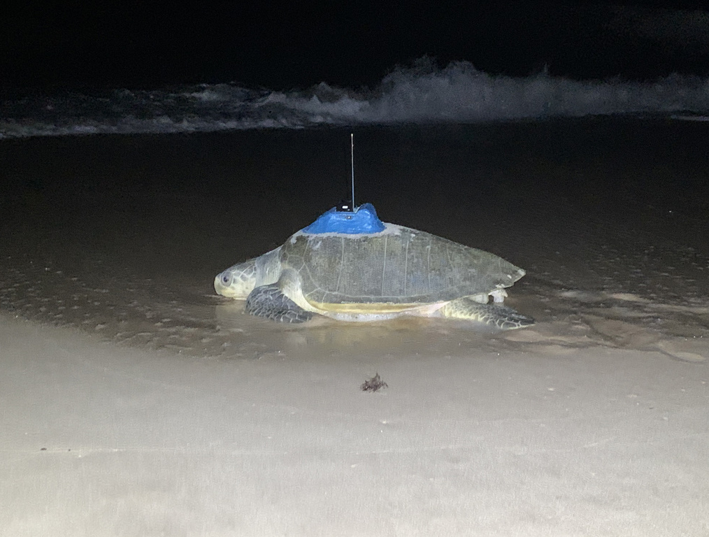
During May this year, the Tiwi Islands Marine Rangers, the first Aboriginal marine rangers in the NT, invited researchers to tag olive ridley turtles. The Rangers and researchers tagged 20 olive ridley turtles over several nights, equipping them with satellite-linked GPS biologgers.
Olive ridleys are one of the most under-studied species in Australia. Attaching GPS biologgers to the turtles will provide much needed information on turtle migratory movements, habitat uses and their foraging behaviour, which in turn will assist in understanding how the turtles use the seas to the north of Australia and how the animals interact with their environment including interactions with fisheries.
Once tagged the turtles move off the beach and head into the ocean, providing data about their movements and dive behaviour in real time. The map below demonstrates the differences already apparent in their behaviour. The names that can be seen on the map were given to some of the turtles by the Tiwi Islands Marine Rangers, who named them after their daughters and other female family members.
Increasing our knowledge of the turtle’s behaviour at-sea will allow us to develop high quality integrated habitat-behaviour models. These models will demonstrate which parts of the Timor and Arafura Seas are important for olive ridley turtles, and when linked to remotely sensed environmental data and known bathymetry we will be much better placed to combine environmental states with behaviour and at-sea animal performance.
Ultimately, the essential behavioural observations this project is collecting will result in improved animal behaviour and habitat use models that will allow us to quantify which areas are important, and with traditional owners and management agencies refine the designation and protection of areas critical for the turtles nesting and feeding. This is exactly the kind of information needed to support the development of better conservation and improved management policy for this iconic, endangered species that we currently know so little about.