Celebrating 20 years of sustained marine observing
The sea level climate data record derived from satellite altimetry underpins how we understand the ocean and its response to a changing climate. By capturing measurements of waves, tides, circulation and long-term sea level trends, this record provides critical evidence for science, policy and decision-making. Ensuring its accuracy through rigorous calibration and validation is essential, forming a fundamental component of global satellite mission design and delivering confidence to users.
Australia relies on satellite altimeter missions operated by international partners, including NASA, NOAA, CNES, EUMETSAT and ESA. The IMOS Satellite Altimeter Calibration and Validation sub-Facility plays a critical national role by delivering ‘absolute calibration’ of these satellite measurements directly to mission agencies. Since its inception, the facility has supported a succession of landmark missions, including TOPEX-Poseidon, the Jason series, Sentinel-3A and 3B, and Sentinel-6 Michael Freilich.
Ongoing innovation has seen the Facility expand its reach into the Southern Ocean, enabling validation of wave measurements from newer missions such as CFOSAT. More recently, it was temporarily enhanced to support the transformative SWOT mission, and is now focused on Sentinel-6B, the latest addition to the global altimetry constellation.
“Internationally recognised, the IMOS Satellite Altimetry Calibration and Validation sub-Facility has been continuously selected to contribute to science and validation teams led by global mission agencies. Its work has helped validate the satellite-derived sea level climate record to sub-centimetre precision, providing a robust foundation for understanding sea-level rise and its acceleration over the past three decades.”
Associate Professor Christopher Watson, Facility Lead
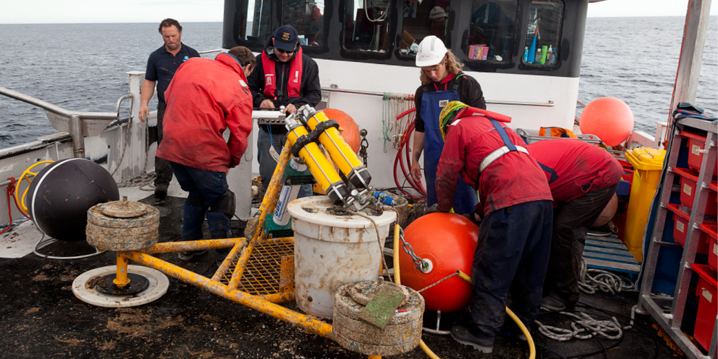
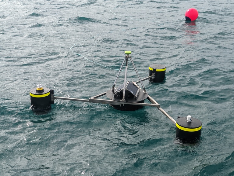
At the core of this capability is a long-term in situ observing system, including moored measurements of bottom pressure, temperature, salinity and ocean currents, alongside surface observations from GNSS-equipped buoys. These complementary datasets not only enable high-precision satellite validation, but are also openly available and widely used, from supporting fisheries and offshore industries to advancing oceanographic research in regions such as Bass Strait.
To date, Satellite Altimetry Calibration and Validation data has been used to produce 139 publications, 37 projects, 53 policy documents and 87 presentations.
Featured image: CSIRO ocean sensor deployment technicians ready The Jason II mooring for redeployment, Storm Bay, Tasmania. Photo by Carlie Devine (CSIRO)