Written by Salman Khan, Marites Canto, Mark Hemer, and Hamish Ramsay (CSIRO, Environment)
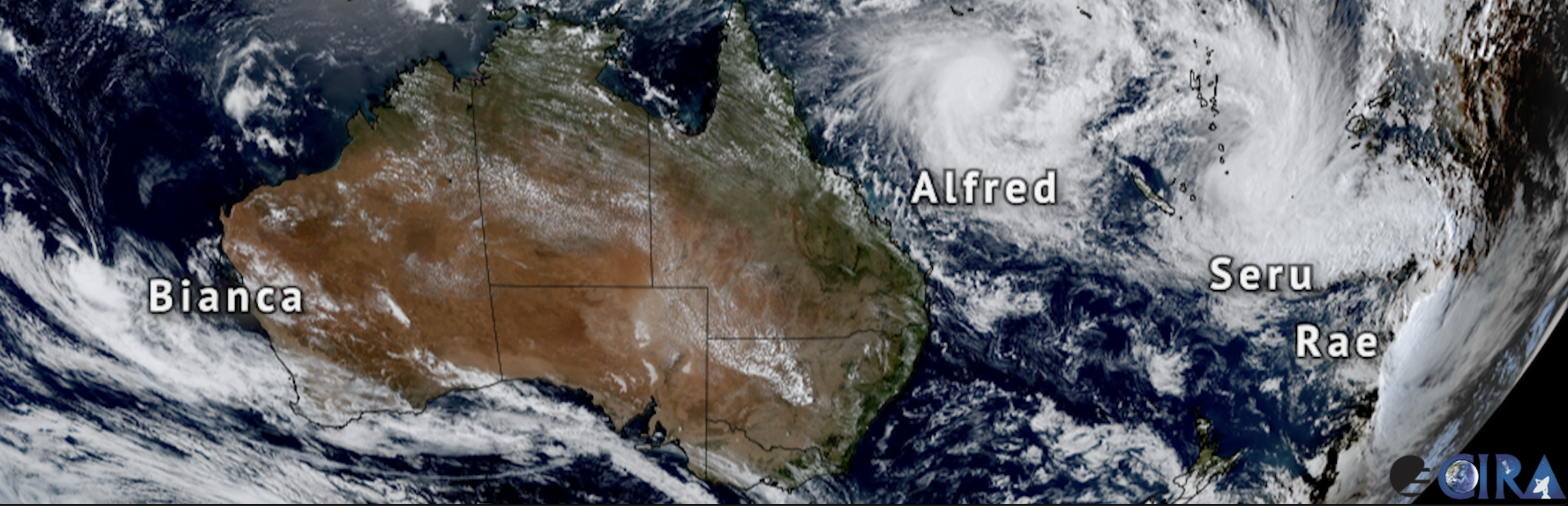
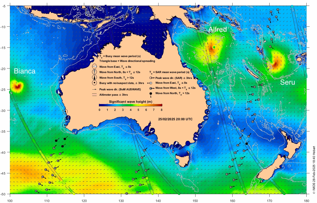
Just a week or two ago there were four tropical cyclones lurking to the west and east of Australia: Bianca in the South Indian Ocean, and Alfred, Seru, and Rae in the South Pacific. The wave fields from Bianca, Alfred and Seru captured simultaneously by the IMOS OceanCurrent wave tool below is a unique occurrence.
Ocean observing satellites are well suited to capturing the broad geographical scales of these systems with several passing close to the TCs, and sampling important attributes of the observed wave field in the time snapshot shown. Wave heights of Bianca and Alfred, and swell periods and directions of Seru match well with the background modelled wave field from the Bureau of Meteorology.
TC Alfred has been a persistent and slow-moving system in recent days. Initially heading in the Southerly direction, it has made a dramatic right turn towards the Southeast Queensland (SEQ) coast. It is forecast to make landfall somewhere between Brisbane and Sunshine Coast with impacts warnings from K’gari (Fraser Island) to as far south as Coffs Harbour, NSW.
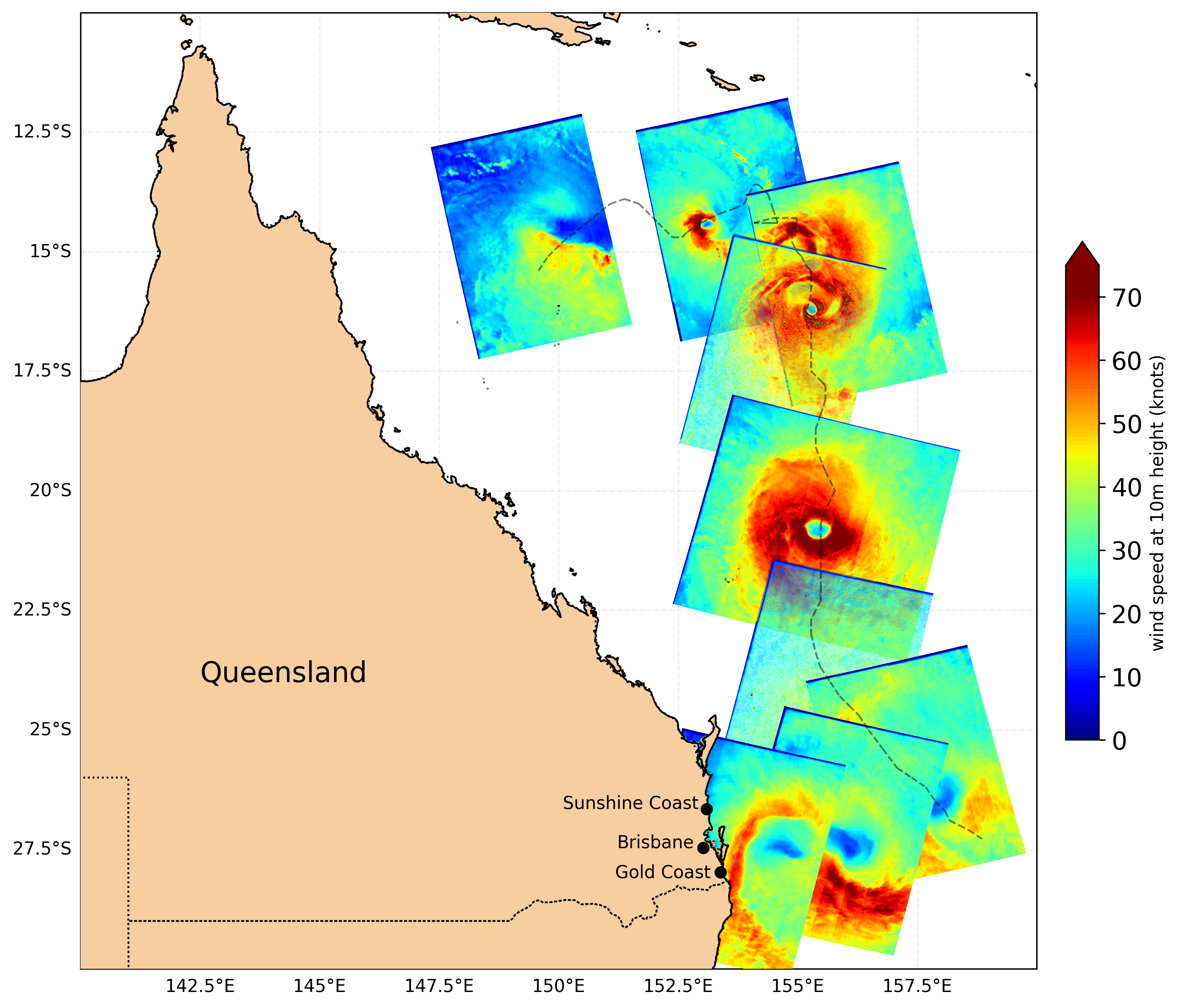
TC Alfred’s near surface wind speeds as observed through a combination of SAR satellites (Sentinel-1, Radarsat-2, Radarsat Constellation Missions1+2+3) reveal detailed structure of the storm and its wind speed characteristics (radii of maximum winds and their decay profile in each quadrant, storm asymmetry, storm centre, etc.), thanks to the unprecedented sub-kilometre spatial resolution of SAR technology (~500m in this case). Such data are invaluable for collecting detailed information on TCs at broadscale and have the potential to improve storm forecasts and help prepare for their impact.
The recent wave conditions along the SEQ coast from the IMOS wave visualisation tool as TC Alfred makes its way westward are captured in the short animation (from IMOS OceanCurrent), below.
While satellites sample the extreme waves offshore, the coastal wave buoys measure the waves in-situ along various parts of the coastline. Circles near the coastline indicate wave measurements from Australia’s wave buoy network near real time feed. Significant wave heights in metres are indicated by the colour bar on the map. Notice how colours change from blue to green (to yellow on some locations, meaning bigger waves) as the system becomes proximal to the coast. Background colours are modelled wavefield from Bureau of Meteorology’s AUSWAVE-R coinciding with the cyclone system.
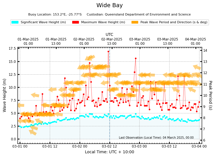
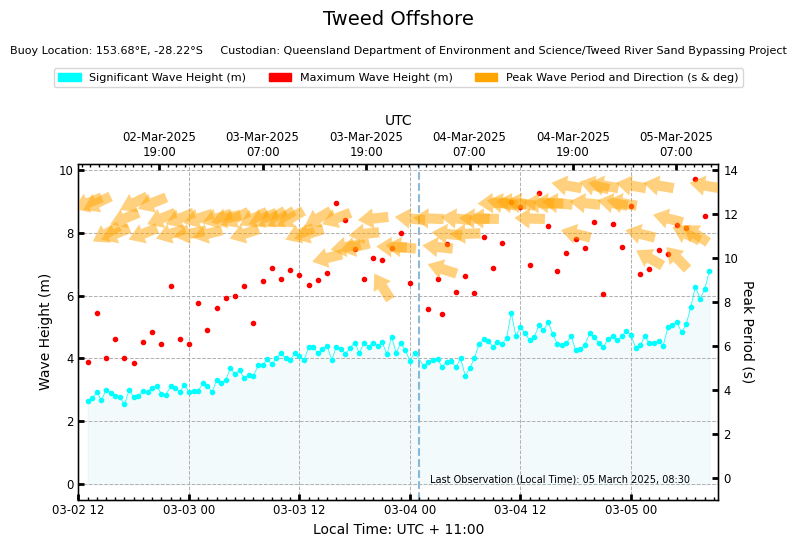
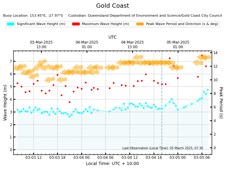
The time series plots of wave information measured at Wide Bay, Tweed Offshore, and Gold Coast confirm high wave conditions and increasing in magnitude (at Tweed offshore and Gold Coast) ~5-9m significant wave heights, maximum wave height upwards of 15m (Wide Bay), and predominantly ~12 sec long Easterly wave systems generated by TC Alfred. These conditions have been, and continue to be, sustained over several days leading to significant stress on coastal systems. Thanks to the Queensland Department of Environment and Science for making these data easily available. More information is available here.
As the residents under impact from TC Alfred brace themselves from the numerous potential hazards (storm surge, coastal erosion, heavy rain, flash flooding, persistently strong winds etc.), we wish them safety through this event and encourage them to understand the warnings and make every effort to follow the directions provided by the relevant authorities.
More information about Tropical Cyclone Alfred, forecast and advice is available at the BOM.